
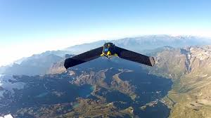
senseFly recently upgraded the software on its eBee aerial mapping drone to t makes it easier for agricultural professionals to capture high-resolution photos of their fields and analyse crop health. The eBee Ag now runs a new feature -packed, yet simple to use, version of senseFly’s Postflight Terra 3D data processing software. Adam Klaptocz, Head of Hardware and Mechanical Engineering at senseFly, gives us an in-depth look at the unmanned aerial system and its capabilities.

http://www.engineeringtv.com/video/eBee-Drone-Optimized-for-Agricu;Engineering-TV-AerospaceDefense